Saturday, 18 May 2013

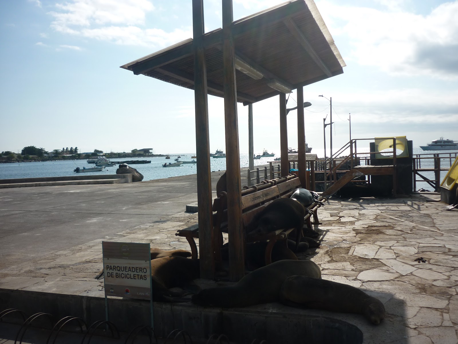
Galapablog Day 2: San Cristobal


Galapagos Islands, Ecuador - San Cristobal, Friday 10th May

Our first full day on the Galapagos Islands started out with an introduction to kayakking and after an initial spurt of highly unco-ordinated paddling, we found sealions diving under our kayak as we made our way around the headland, encountering pelicans, "Sally Lightfoot" crabs (which I will always associate with the Prodigy album cover), frigate birds and one of the symbols of the islands, blue-footed boobies (not just a plummetting diving bird, with very bright blue feet, but also a great opportunity to sell all manner of "I love boobies" merchandise, naturally).

Unlike many visitors to the islands, we stayed at various hotels on the islands, rather than staying on a cruise ship and visiting the islands on day trips - this had the advantage of putting money into the islands' economies although maybe meant that we saw less of the farther flung islands than the cruisers. We were constantly surprised by how unruffled the animals and birds were by human presence and how little they stirred, even when we walked right past them.

In the afternoon, we had two walks - the first to el Junco, a freshwater lagoon surrounded by plants and ferns that have adapted to San Cristobal and the second to the Opuntia (cactus) forest.

The highlights of the first walk (up a hill on a slightly decrepit wooden walkway) were the views across the island and the constant wheeling overhead of the frigate birds, who skim across the surface of the freshwater to get the salt off their wings after hanging around at the seaside to steal fishes off other fishing birds. Having grown up with a book of birds which featured a big photo of a male frigate bird with an inflated red neck pouch, it was a special moment for me to see these exotic birds swooping down into the water, dipping their wings and shaking off the water, whilst taking care to not get too wet so that they were still able to soar up into the sky again.

The second walk through the cactus forest was another bird-spotting opportunity, although the birds in question this time tended to be mockingbirds, the ubiquitous yellow warblers and various finches, flitting about on the different types of cactus and native plants, including the Galapagos cotton plants and presumably avoiding the poisonous apple trees, whose fruit is harmless to giant tortoises but deadly to everything else. Unfortunately we did not have the time to walk along the trail all the way to the beach, but still saw plenty of plants and birds and picked up lots of persistently sticky seeds en route.

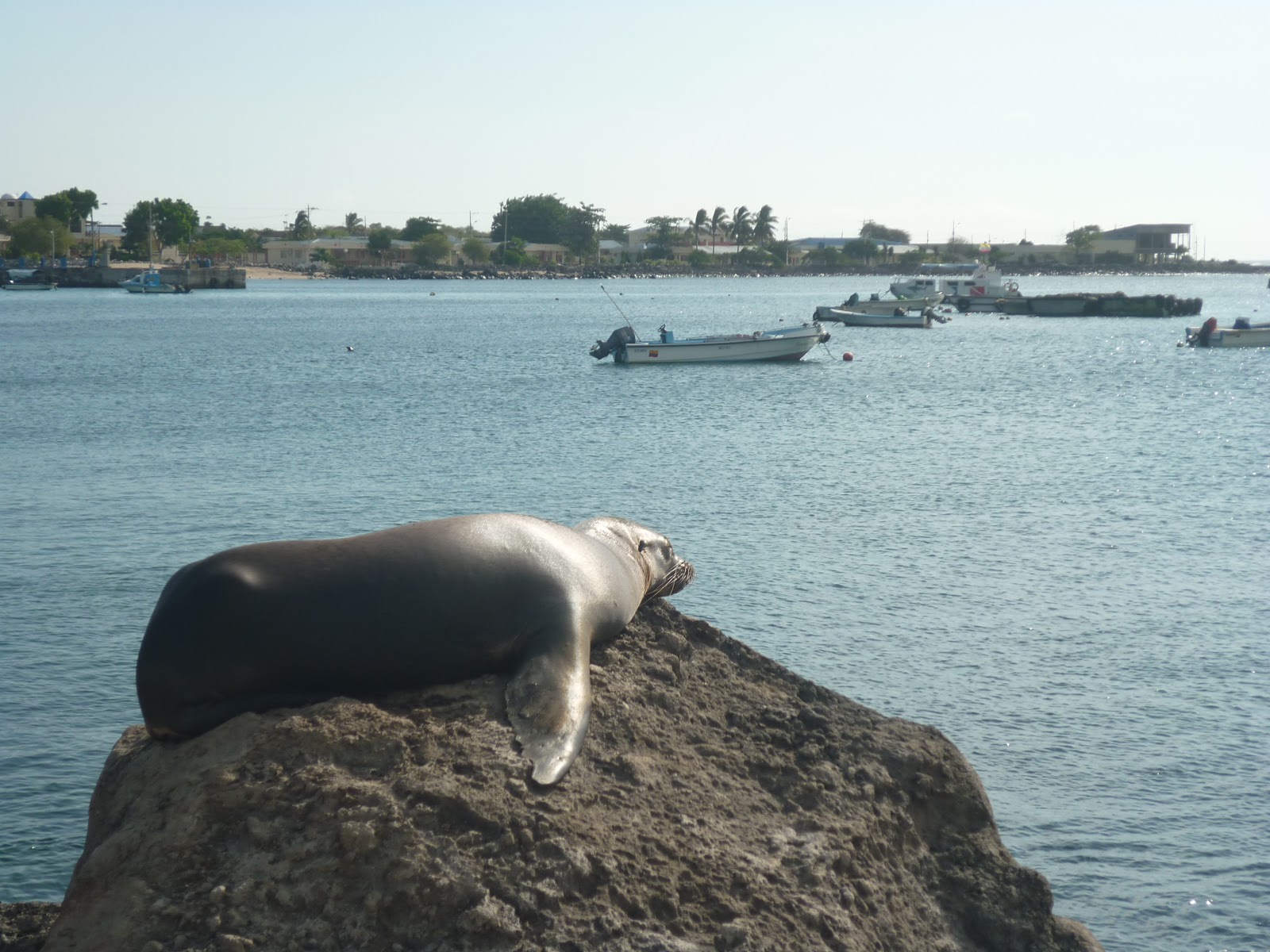
  

Galapablog Day 1: San Cristobal


Galapagos Islands, Ecuador - San Cristobal, Thursday May 9th 2013

Up until this point, this blog has been a place where I have reviewed and rated various walks made around the UK, however given that we have just spent a week in the Galapagos on a tour organised by a specialist walking tour company - HF Holidays - I felt I could justify stretching the boundaries of the blog a little!

Although there were some great walking components to the holiday, there was probably a little less walking - and a little more snorkelling and kayakking - than we originally expected, however this was still a very special, once-in-a-lifetime experience and the heat of the equator meant that a full-on walking experience would have been downright exhausting.

We started out by flying into the Ecuadorian capital, Quito (the highest capital city in the world), on the Tuesday night, then flying on to the closest Galapagos Island, San Cristobal, the following day.

Our first afternoon on the island was understandably relaxed, consisting of little more than a nice lunch and a walk along the beach to the Loberia (sea lion hangout and great spot for snorkelling and surfing). There were a few sea lions and a stationary turtle on the beach, plus lots of (sadly unphotographable) tropical fish in the sea and the walking component of the day was limited to a stroll back to town along the very quiet road, with a fleeting glimpse of a short-eared owl.

We were part of a sociable and predominantly female group of 14, mainly Brits, with a few Americans and Canadians, a very attentive and knowledgeable Ecuadorian guide, Xavier, and local guides on each island (today's guide: David, whose "it's gonna be super-awesome guys" patter was ever so slightly incongruous).    

Sunday, 14 April 2013

Wandering near Wendover


Date: Sunday 14th April 2013
Route: Wendover Circular via the Icknield Way, the Aylesbury Ring and a rather nice pub
Distance: 8.4 miles

This is the first walk in the Time Out Book of Country Walks Volume 2, which they describe as "an exhilarating introduction to the Chilterns". Today "exhilarating" could be construed to mean "a bit strenuous and exposed in places", but we still enjoyed this walk a lot.

I know that we have walked this route several times in the past (the last time in very snowy conditions - click here to see some Narnia-esque photos) but I think today's trip was possibly the most heavy-going, mainly due to some very muddy fields and a bit more breeze than expected.

The walk is a nice combination of fields and woodlands, including Pulpit Hill Fort, until a certain point when you emerge from the trees to one of those rolling hillside views that never translate well on camera but are absolutely stunning in the sunshine and make you wish you had packed a picnic. The best bit of the walk is probably the section from the vicinity of Chequers, over Beacon Hill and down to Ellesborough Church, as this gives you great views over the open countryside of the Chilterns, whose beauty is only slightly undermined by frequent ugly and amusingly ungrammatical "Stop HS2" signs and banners.

From the church back to Wendover can become a bit of a trudge, mainly alongside fields of sheep, but we broke up this section today with lunch at the highly recommended Russell Arms - fantastic cheese & chutney sandwiches and chips refuelled us for the final section back to Wendover.

There is a fair amount of hillside walking in this one, so it is definitely a bit more punishing than the walks near Henley - and if you are feeling particularly energetic you can do the longer, 11.5 mile version (we didn't!). I would like to do this again when the ground is a bit drier so I don't feel as if there is a kilo of mud on the underside of each boot, though. I would also recommend the Wendover walk from the Rough Guide Walks Near London book if you want a less rigourous option.

Sunday, 7 April 2013

Hambleden, Marlow and the Thames


Date: Sunday 7th April
Route: Hambleden to Marlow and back along the Thames Path & across Medmenham Lock
Distance: 12.1 miles

A beautiful sunny spring day and one of the best walks from the Time Out Country Walks near London Volume 2 - to paraphrase Masterchef "walking doesn't get any better than this!"

The walk, as detailed in the guide book, begins and ends in Marlow, however we chose to park in the car park on the road to Hambleden, so that we had more choice of places to eat in Marlow (and got the big hilly bits out of the way in the first half of the walk). Another alternative is to park in the free car park within Hambleden village.

The walk offers a great combination of hills and woodland, beautiful countryside, riverside walking, bridges, locks and weirs. Along the way today we encountered loads of wildlife - from red kites and deer to a lone fox on the hillside and even a crazy-looking turkey alongside the Flowerpot Hotel on the hillside above Medmenham Lock.

There are a few hills along the way and you can tell that you've walked a fair distance, however this is a really satisfying walk (and much better than the Marlow Walk in the Pathfinder Chilterns book).

Monday, 1 April 2013

Alpacas, kayakkers and disorienteering around Henley


Date: Saturday March 30th 2013
Route: Circular walk from car park on Skirmett Road to Hambleden, through the Great Wood to Henley then back along the Thames and Medmenham Lock
Distance: 9.8 miles

When you walk the same paths regularly, it's tempting to decide that there's nothing new to say and therefore not much point in blogging - apart from the fact that this is pretty self-defeating (and means that we will inevitably forget where we have walked on which dates!), our chilly walk on Saturday was proof that even a familar path can deliver new and different things every time you step onto it.

The walk in question is the first walk in the Time Out Book of Country Walks and the one that I would recommend to everyone without a moment's hesitation. I've blogged about it a few times now, so won't go into the detail of the route today, but you can check out more information in previous posts, if you fancy it.

There were a few factors that made our walk on Saturday more interesting (and at times, noisier!) than usual:
1. Water
2. Orienteering 
3. Wildlife
4. Canoe racing

The first section of the walk, from the car park to the picture-book village of Hambleden, crosses a couple of fields, with the village away in the distance, cows lazing on the hillside and red kites wheeling overhead. A few years ago, a stream meandered across the fields alongside the path, however in the last 18 months-2 years of "drought" conditions it had disappeared - needless to say that the recent rubbish weather has brought it back with a vengeance and very pretty it is too (although Wellies and/ or waterproof boots definitely come in handy, as the path can be a bit boggy in places).

As far as the orienteering was concerned, this certainly made the steep hillside section of the walk a lot busier than usual, as a small army of Lycra-clad, lean and sprightly individuals marched up to the start of their event and then proceeded to tear around the woodland, compasses in hand, while we walked our way through the middle of them. A temporary village of tea vans, medical tents and a P.A. system meant that part of the walk was not exactly the quiet country stroll it usually is, accompanied as it was by a running commentary - not sure that the event organisers had really thought through the implications of placing the urinals right next to the footpath either!

Once away from the mayhem of the woodland, we encountered more than our usual quota of wildlife - coming face to face with friendly and plantive domesticated alpacas, obviously in the market for any spare snack food we might have with us, as well as a large herd of deer on the hillside above Henley, presumably fleeing from the dashing orienteers and keen not to get too close to us either.

After lunch in Henley, even the final stretch of the walk, along the Thames Path, had surprises in store, as we were steadily overtaken by a stream of kayakkers and canoeists taking part in the 125 mile Devizes to Westminster International Canoe Race. By the time they reached Henley, they had paddled through the night in fast-flowing water, freezing temperatures and biting wind - and still had a long way to go, with the only "rests" being the sections where they had to carry the canoes around obstacles such as Medmenham Lock before carrying on downstream.

All of this hardcore outdoor exercise makes walking look a little wussy in comparison, however whilst I can appreciate the effort and challenge of these outdoor events, I'm not sure I will be rushing to pick up a compass and map or a paddle any time soon - for me, an interesting path, some slightly challenging hillsides and a nice pub lunch win any day!


Friday, 22 March 2013

Mullion Cove


Date: Wednesday 20th March 2013
Route: Circular route from Mullion Cove
Distance: 7 miles

With a beautiful day instore, we decided to tackle another walk on the Lizard Peninsula from the AA's 1001 Walks.

A bit further round the coast than Kynance Cove, the starting point for a walk earlier in the week, Mullion Cove boasts a small working harbour owned by the National Trust and once a mainstay of the pilchard industry.

The walk starts off by heading up onto the hillside away from the coast, crossing farmland and the Kynance Nature Reserve, before returning back to Mullion Harbour along an open and at times slightly boggy section of the coastal path.

It is no surprise that this walk is situated in an official Area of Outstanding Natural Beauty, although I would say that the Lizard walk that I blogged about previously is slightly more beautiful.

I must admit, I may just be slightly less enthusiastic about this walk because we got a bit lost and ended up on a very muddy trail (see photo above); slipping into a muddy puddle and getting so dirty that my husband refused to give me a hand up probably wasn't a high point of the walk either, but despite all of this, I would still recommend this walk (though possibly when the land has dried out a bit!).

Sennen Cove & Land's End


Date: Tuesday 19th March 2013
Route: Sennen Cove past Land's End and back again
Distance: 3 miles-ish

With glowering skies and a dire weather forecast, we needed a quick walk that would blow away the cobwebs but not result in us being blown away in turn!

The solution we chose was to drive down to Sennen Cove, which we have passed through a few times on sections of the Coastal Path, to take the rugged and well-trodden path to Land's End. Having past the old coastguard station and the wreck of the RMS Mulheim (which crashed because the captain caught his trousers on a lever on his chair and knocked himself unconscious, if Wikipedia is to be believed!), we headed over the hillsides to find various tourists having their photos taken and grumbling about the lack of non-Fairtade teabags at the visitor's centre, while a small army of handymen painted, mended and generally set about getting everything ready for the coming summer influx of holidaymakers.

Once past Land's End, the number of people on the path drastically reduced, leaving us with space to contemplate the rocky scenery, watch the waves crash against the cliffs and listen to the noise of the sea and the wheeling seabirds. Admittedly, this felt like a walk of two halves, but it was still a great way to spend a morning before the rain came in.